Abby Darrah, MS Co-Chairperson
Audubon Delta
Abby.Darrah@audubon.org
Roger Clay, AL Co-Chairperson
Alabama Department of Conservation and Natural Resources
roger.clay@dcnr.alabama.gov

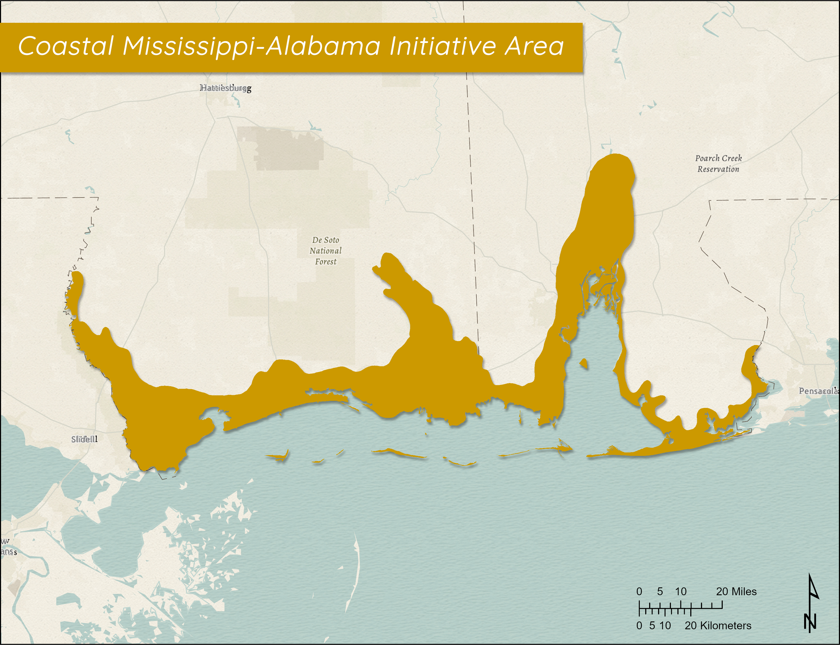
The Coastal Mississippi-Alabama Initiative Area includes parts of Hancock, Harrison, and Jackson Counties along the Mississippi coast and portions of Mobile and Baldwin Counties in coastal Alabama. The Initiative Area extends eastward from the Louisiana-Mississippi border to Perdido Bay on the Alabama-Florida border and inland.
The Mississippi portion of the Initiative Area encompasses a total land area of 1.17 million acres and is comprised of a variety of land types. including brackish to saline marsh and coastal pine flatwoods. The Mississippi coastline, which includes large bays and estuary systems, is separated from the Gulf of Mexico by Mississippi Sound and a series of narrow barrier islands. Mississippi Sound and adjoining bays are estuarine water bodies that experience wide variation in salinity, ranging from almost complete freshwater floods to high influxes of saltwater. Most notably within the Initiative Area, Mississippi's marine coastline is bisected by four large drainage basins that include the Pearl River, Pascagoula River, Biloxi Bay, and St. Louis Bay system. These basins account for approximately 67% (40,000 acres) of Mississippi's coastal wetlands. Another important habitat type in the Mississippi portion of the Initiative Area is the extensive forested wetlands.
The Alabama part of the Initiative Area consists of large bay and estuary systems that are nearly isolated from the Gulf of Mexico by barrier islands or peninsulas. Most notably within the Initiative Area, Mobile Bay is the sixth largest drainage basin in the United States and receives drainage from almost two-thirds of Alabama and portions of Georgia, Mississippi, and Tennessee. The bay extends over roughly 400 square miles and ends at the Gulf Shores-Fort Morgan Peninsula and Dauphin Island. Similar to the Mississippi portion, another important land type within the Alabama part of the Initiative Area is the extensive forested wetlands located in the Mobile-Tensaw River Delta (at the confluence of the Alabama and Tombigbee Rivers and extending southward 45 miles to the head of Mobile Bay).
GCJV Bird Conservation Plans for Coastal Mississippi-Alabama Initiative Area

 700 Cajundome Blvd.
Lafayette, LA 70506
Phone: 337-262-7001 Fax: 337-262-7000
Copyright 2020 Gulf Coast Joint Venture - Webmaster